While it may seem like technology and conservation efforts are as compatible as oil spills and pristine beaches, the reality is quite the opposite. In fact, technology has become an invaluable tool in the fight to protect and preserve our planet’s fragile ecosystems. From remote sensing and wildlife tracking to artificial intelligence and robotic assistance, the ways in which technology is aiding conservation efforts are both diverse and promising. In this discussion, we will explore the various ways in which technology is making a difference in the world of conservation, shedding light on the innovative solutions that hold the key to a more sustainable future.
Remote Sensing in Conservation
In our efforts to conserve natural resources, we rely on remote sensing technology. Remote sensing applications have revolutionized conservation efforts by providing us with valuable data and insights into our environment. Through the use of satellites and aircraft equipped with sensors, we can gather information about the Earth’s surface and monitor changes over time.
Conservation technology advancements have made it possible for us to monitor deforestation, track wildlife populations, and assess the health of ecosystems. With remote sensing, we can identify areas at risk of degradation and prioritize conservation efforts accordingly. This technology allows us to monitor large areas that would be otherwise difficult to access, making it an invaluable tool for conservationists.
One of the key benefits of remote sensing in conservation is its ability to provide real-time data. With this information, we can respond quickly to environmental threats and implement effective strategies to mitigate them. For example, by monitoring changes in land cover, we can identify areas where illegal logging is taking place and take immediate action to stop it.
Furthermore, remote sensing technology enables us to monitor the impacts of climate change on ecosystems. By analyzing changes in temperature, rainfall patterns, and vegetation cover, we can better understand how ecosystems are responding to these changes. This information is vital for developing adaptive management strategies and conserving vulnerable species.
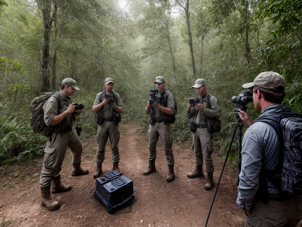
Wildlife Tracking and Monitoring
With our remote sensing technology providing us valuable data and insights into the environment, we can now shift our focus to the crucial task of wildlife tracking and monitoring. In the realm of wildlife conservation technology, animal tracking methods have become increasingly sophisticated and effective. Here are three ways in which technology is revolutionizing wildlife tracking and monitoring:
- GPS Tracking: Gone are the days when researchers had to physically follow animals to understand their movements. With the advent of GPS tracking devices, we can now effortlessly track the precise location of animals in real-time. These devices are often attached to collars or tags that animals wear, allowing us to gather data on their migration patterns, habitat preferences, and behavior. This information is invaluable for designing targeted conservation strategies and protecting critical habitats.
- Camera Traps: Camera traps have revolutionized the way we study elusive and nocturnal wildlife. These devices are equipped with motion sensors that trigger them to capture images or videos whenever an animal passes by. By placing camera traps in strategic locations, we can gather data on animal populations, behavior, and interactions without disturbing their natural habitats. This non-invasive method gives us an intimate glimpse into the lives of animals that would otherwise be difficult to observe.
- Remote Sensing: In addition to monitoring individual animals, technology allows us to monitor entire ecosystems. Remote sensing techniques, such as satellite imagery and drones, provide us with a bird’s-eye view of vast landscapes. By analyzing these images, we can identify changes in vegetation, water bodies, and land use patterns, which can help us understand the health of ecosystems and the potential threats faced by wildlife.
Geographic Information Systems (GIS)
Let’s talk about Geographic Information Systems (GIS) and its importance in conservation efforts. GIS mapping applications allow us to create detailed maps and analyze environmental data in order to better understand and protect our natural resources. By using GIS technology, we can identify areas of high biodiversity, track habitat changes, and make informed decisions to promote conservation and sustainable development.
GIS Mapping Applications
Using GIS mapping applications is an effective way to analyze and visualize geographic data for conservation efforts. Through these applications, we can gain valuable insights into the environment and make informed decisions to protect it. Here are three key benefits of using GIS mapping applications for environmental data analysis:
- Data Integration: GIS mapping applications allow us to combine various types of data, such as satellite imagery, GPS data, and environmental monitoring data. This integration provides a holistic view of the environment and helps us understand the complex relationships between different factors.
- Spatial Analysis: With GIS mapping applications, we can perform spatial analysis to identify patterns, hotspots, and trends in environmental data. This analysis helps us identify areas that require immediate attention and prioritize conservation efforts effectively.
- Visualization: GIS mapping applications offer interactive and visually appealing ways to represent geographical data. By creating maps, charts, and graphs, we can communicate complex information in a more understandable and engaging manner, fostering a deeper connection between people and the environment.
Through the use of GIS mapping applications, we can harness the power of technology to better understand and protect our natural world.
Environmental Data Analysis
Environmental data analysis is a crucial component of Geographic Information Systems (GIS) that allows us to gain valuable insights into the environment and make informed decisions for conservation efforts. By analyzing environmental data, we can assess the environmental impact of human activities and understand the effects of climate change on ecosystems.
One way we use GIS for environmental data analysis is by creating maps that visually represent complex data sets. These maps provide a clear and concise way to understand patterns and trends in environmental data. For example, we can use GIS to map the distribution of endangered species and identify areas that need protection.
Another important use of GIS in environmental data analysis is modeling and simulation. By inputting data on various factors such as temperature, precipitation, and land use, we can simulate different scenarios and predict the potential impacts of climate change on ecosystems. This allows us to develop strategies for conservation and mitigation efforts.
| Benefits of Environmental Data Analysis in GIS |
|---|
| Clear visualization of complex data |
| Identification of areas needing protection |
| Prediction of climate change impacts |
| Development of conservation strategies |
Drones in Conservation Efforts
Drones have revolutionized conservation efforts by providing a unique perspective and enhancing data collection. These autonomous flying machines have become invaluable tools in preserving our planet. Here are three ways in which drones are making a significant impact in conservation:
- Aerial Surveillance: Drones equipped with high-resolution cameras allow us to monitor vast areas of land and sea with ease. They can capture detailed images and videos, providing valuable insights into the health and behavior of wildlife populations. From tracking endangered species to identifying illegal activities like poaching or deforestation, drones enable us to gather crucial information from above that would be otherwise difficult to obtain. Their ability to fly low and navigate through challenging terrains makes them particularly effective in remote and inaccessible areas.
- Habitat Mapping: Drones equipped with advanced sensors can create detailed maps of ecosystems and habitats. By capturing aerial images and using specialized software, conservationists can analyze vegetation patterns, identify potential threats, and plan conservation strategies accordingly. This technology allows us to understand the dynamics of ecosystems and make informed decisions to protect and restore them. Drones provide a cost-effective and efficient way to gather data that was previously time-consuming and labor-intensive.
- Wildlife Monitoring: Drones equipped with thermal imaging cameras and other specialized sensors can detect and track wildlife populations without disturbing them. This non-intrusive approach allows researchers to study animal behavior, migration patterns, and population dynamics more accurately. By collecting data from above, drones offer a less invasive alternative to traditional methods like ground-based surveys or radio telemetry. They provide a bird’s-eye view that helps us better understand and protect the delicate balance of our ecosystems.
Drones have transformed the way we approach conservation. With their unique capabilities, they are helping us make significant strides in preserving our planet’s biodiversity. Their aerial perspective and enhanced data collection capabilities have opened up new possibilities and empowered us to take more effective conservation actions.
Artificial Intelligence (AI) in Wildlife Conservation
Now let’s talk about how Artificial Intelligence (AI) is making a significant impact in wildlife conservation efforts. AI technology is being used to track and monitor endangered species, allowing us to gather valuable data on their behaviors and habitats. Additionally, AI is being employed to detect and prevent poaching activities, aiding in the protection of vulnerable wildlife populations. Furthermore, AI is revolutionizing wildlife research by enhancing data analysis and interpretation, enabling us to gain a deeper understanding of the complex ecosystems we are striving to conserve.
AI Tracking Endangered Species
Using advanced artificial intelligence technology, we can now track endangered species more effectively in wildlife conservation efforts. AI-powered conservation drones equipped with advanced tracking algorithms have revolutionized the way we monitor and protect endangered species. Here are three ways AI is making a significant impact:
- Real-time monitoring: AI-powered drones can collect and analyze data in real-time, allowing us to track the movement patterns, behavior, and population dynamics of endangered species accurately. This information helps us understand their habitat requirements and develop targeted conservation strategies.
- Enhanced surveillance: AI algorithms can process vast amounts of aerial footage captured by drones, making it easier to identify and locate endangered species. This enables conservationists to respond quickly in case of poaching threats or habitat destruction, ensuring the safety and protection of these vulnerable animals.
- Data-driven conservation: By utilizing AI technology, we can analyze complex data sets gathered from tracking systems and satellite imagery. This data-driven approach provides valuable insights into the ecological needs of endangered species, helping us make informed decisions and implement more effective conservation measures.
With AI tracking, we are better equipped to safeguard endangered species and preserve our natural heritage for future generations.
AI Monitoring Poaching Activity
AI monitoring poaching activity is a crucial application of artificial intelligence in wildlife conservation efforts. By using AI algorithms and advanced surveillance technologies, we can track and detect illegal activities, such as poaching, in real-time. AI-powered cameras and sensors are deployed in strategic locations, constantly monitoring wildlife habitats and identifying suspicious behavior. This data is then analyzed, allowing conservationists to quickly respond and prevent poaching incidents. Additionally, AI can predict wildlife population dynamics, helping conservationists make informed decisions about conservation strategies and resource allocation. With AI’s ability to analyze vast amounts of data and detect patterns, we can better understand animal behavior and anticipate potential threats to their survival. This technology plays a vital role in safeguarding endangered species and preserving our planet’s biodiversity.
| AI Tracking Animal Behavior | AI Predicting Wildlife Population Dynamics | AI Monitoring Poaching Activity |
|---|---|---|
| Helps understand animal behavior patterns and habits | Provides insights into population trends and changes | Detects and prevents illegal activities in real-time |
| Enhances conservation efforts and protection measures | Assists in resource allocation for effective conservation | Enables quick response to potential threats |
| Facilitates targeted conservation interventions | Guides decision-making for conservation strategies | Protects endangered species and preserves biodiversity |
AI Enhancing Wildlife Research
With its ability to analyze vast amounts of data and detect patterns, artificial intelligence continues to revolutionize wildlife conservation efforts, now extending its impact to enhance wildlife research. Here are three ways AI is contributing to the study and tracking of endangered species:
- AI-powered camera traps: These devices use computer vision algorithms to automatically identify and classify animals captured in images or videos. This technology helps researchers collect data on population sizes, habitat preferences, and behavior patterns of endangered species, aiding in their conservation.
- Acoustic monitoring systems: AI algorithms can analyze audio recordings collected in the field to identify and track the vocalizations of specific species. This enables researchers to monitor the presence, distribution, and abundance of endangered animals, even in remote and inaccessible areas.
- Data analysis and prediction: AI algorithms can process large datasets and identify trends and correlations that may not be immediately apparent to human researchers. This helps in understanding the factors affecting endangered species and predicting future population dynamics, allowing for targeted conservation efforts.
Through AI, wildlife research is becoming more efficient, accurate, and proactive, leading to better conservation strategies and increased chances of protecting endangered species.
DNA Analysis for Species Identification
In our efforts to identify species, DNA analysis has proven to be a powerful tool. DNA sequencing, in particular, has revolutionized species conservation by providing us with an accurate and efficient method of species identification. This technology allows us to analyze the genetic material of organisms, helping us to determine their species with unprecedented precision.
DNA sequencing involves determining the order of nucleotides in a DNA molecule. By comparing these sequences to a reference database, scientists can identify the species to which the DNA belongs. This method is especially useful in cases where traditional identification methods, such as visual observation or physical characteristics, may be challenging or inconclusive.
One of the significant advantages of DNA analysis in species identification is its ability to differentiate closely related species or even subspecies. This level of accuracy is crucial for conservation efforts, as it allows us to identify and protect specific populations that may be genetically distinct or endangered.
Furthermore, DNA analysis can aid in detecting species that are difficult to observe directly, such as elusive or cryptic species. By analyzing environmental DNA (eDNA) samples, which consist of genetic material shed by organisms into their surroundings, we can identify the presence of species even in remote or inaccessible areas.
Technology for Habitat Restoration
Now let’s explore how technology has been utilized in the restoration of habitats. Habitat rehabilitation and ecosystem restoration are crucial for preserving biodiversity and ensuring the survival of various species. With the help of technology, we have been able to enhance and accelerate these restoration efforts, making a significant impact on our ecosystems. Here are three ways in which technology is assisting in habitat restoration:
- Remote Sensing and GIS Mapping: Technology allows us to gather data on habitat conditions and changes from a distance. Remote sensing tools, such as satellites and drones, provide detailed imagery and data on the state of habitats. This information is then combined with Geographic Information System (GIS) mapping to create accurate habitat maps, which aid in identifying areas that require restoration. By pinpointing specific locations, we can focus our efforts more effectively and efficiently.
- Artificial Intelligence (AI) and Machine Learning: AI and machine learning algorithms can analyze large amounts of data to identify patterns and trends in habitat degradation. By studying these patterns, we can gain insights into the causes and effects of habitat loss, which informs our restoration strategies. AI can also help monitor the progress of restoration projects by analyzing real-time data and making adjustments as needed.
- Aquatic Habitat Restoration Technology: Aquatic habitats are particularly vulnerable to degradation. To address this, technology has been developed to aid in the restoration of rivers, lakes, and coastal areas. Techniques such as hydrologic modeling, sediment analysis, and bioengineering solutions are used to rehabilitate aquatic ecosystems. These technological advancements help recreate the natural flow of water, restore water quality, and enhance the habitat for aquatic species.
Through the use of remote sensing, AI, and aquatic habitat restoration technology, we are able to restore and rehabilitate habitats more effectively than ever before. These technological tools provide us with the information and strategies needed to preserve and protect our ecosystems for future generations.
Conservation Genetics and Genomics
Utilizing genetic and genomic research, we can gain valuable insights into conservation efforts and make informed decisions to protect endangered species. Conservation genomics, in particular, is a powerful tool that allows us to understand the genetic diversity and population structure of species, aiding in their conservation.
One important application of conservation genomics is DNA barcoding. This technique involves sequencing a short fragment of DNA from an organism to identify its species. By comparing these DNA sequences to a reference database, we can quickly and accurately identify species, even in cases where traditional morphological identification is challenging. This is particularly useful when dealing with endangered species that are difficult to observe or distinguish from closely related species.
DNA barcoding also helps in monitoring illegal wildlife trade. By analyzing DNA samples from confiscated products, such as ivory or animal parts, we can determine the species involved and track their origin. This information is crucial for law enforcement agencies to combat wildlife trafficking effectively.
Furthermore, conservation genomics provides insights into the genetic health of populations. By analyzing the genetic diversity and identifying potential inbreeding or genetic bottlenecks, we can develop targeted conservation strategies to preserve the long-term viability of endangered species. This knowledge allows us to make informed decisions in terms of breeding programs, reintroduction efforts, and habitat management.
Satellite Imaging for Environmental Monitoring
Satellite imaging plays a crucial role in monitoring and assessing environmental changes. Through satellite data analysis and remote sensing applications, we are able to gather valuable information about our planet’s ecosystems. Here are three important ways satellite imaging is helping in environmental monitoring:
- Tracking Deforestation: Satellite images provide a comprehensive view of forests around the world, allowing us to monitor deforestation patterns and identify areas at risk. By analyzing these images, we can detect changes in vegetation cover, pinpoint illegal logging activities, and develop strategies for conservation and reforestation.
- Monitoring Wildlife Habitats: Satellite imaging helps us monitor the habitats of endangered species and assess their distribution and population dynamics. By analyzing remote sensing data, we can identify suitable habitats, track migration patterns, and evaluate the impact of human activities on wildlife. This information is crucial for implementing effective conservation measures and protecting biodiversity.
- Assessing Environmental Disasters: When natural disasters strike, satellite imaging provides a rapid and accurate assessment of the environmental impact. By analyzing images before and after an event, such as a hurricane or an oil spill, we can evaluate the extent of the damage, identify affected areas, and prioritize response efforts. This allows for a quicker and more targeted response, minimizing the long-term effects on ecosystems.
Satellite imaging, combined with advanced satellite data analysis and remote sensing applications, offers a powerful tool for environmental monitoring and conservation. It provides a global perspective, enabling us to understand the interconnectedness of ecosystems and make informed decisions to protect our planet. By harnessing the power of technology, we can work towards a sustainable future for both nature and humanity.
Augmented Reality (AR) in Conservation Education
Let’s talk about how augmented reality (AR) can revolutionize conservation education. With interactive AR experiences, learners can actively engage with the content, making the learning process more immersive and enjoyable. AR can also provide virtual wildlife encounters, allowing students to experience and learn about endangered species without disturbing their natural habitats.
Interactive AR Experiences
AR technology is revolutionizing conservation education by providing interactive experiences that engage and educate audiences in an immersive and impactful way. Here are three ways interactive AR experiences are making a difference:
- Augmented Reality Gaming: AR is transforming gaming into an educational tool. Through mobile apps and wearable devices, players can explore virtual environments that teach them about endangered species, habitats, and conservation efforts. By gamifying conservation, AR makes learning fun and encourages active participation.
- Interactive Museum Exhibits: AR is enhancing museum exhibits by bringing static displays to life. Visitors can use their smartphones or tablets to interact with virtual elements overlaid on exhibits, such as 3D models, videos, and interactive quizzes. This interactive experience deepens understanding and fosters a sense of connection with the subject matter.
- Virtual Field Trips: AR allows students to go on virtual field trips, exploring remote locations and observing wildlife in their natural habitats. Through AR goggles or screens, students can interact with virtual animals, plants, and ecosystems, providing a unique and immersive learning experience without leaving the classroom.
AR technology is revolutionizing conservation education, creating interactive and engaging experiences that leave a lasting impact on audiences.
Enhancing Learning Engagement
Using augmented reality (AR) in conservation education enhances learning engagement by providing interactive and immersive experiences that captivate and educate audiences. With AR, learners can explore virtual environments and interact with virtual objects, making the learning experience more dynamic and engaging. This technology allows individuals to visualize complex concepts and processes, such as the impact of deforestation on ecosystems, in a way that is easy to understand and remember. Furthermore, AR can be combined with robotic learning, where learners can interact with robotic animals or plants, gaining a deeper understanding of their behavior and conservation needs. By incorporating AR and robotic learning, conservation education becomes a virtual engagement that brings conservation issues to life, inspiring learners to take action and contribute to the preservation of our planet’s biodiversity.
| Interactive Experiences | Immersive Learning | Captivating Education |
|---|---|---|
| Virtual environments | Dynamic engagement | Easy understanding |
| Visualizing concepts | Remembering | Impact awareness |
| Robotic learning | Interacting | Inspiring action |
Virtual Wildlife Encounters
After exploring the benefits of augmented reality in enhancing learning engagement, it is time to delve into the exciting world of virtual wildlife encounters in conservation education.
- Virtual reality experiences: Thanks to advanced technology, we can now transport ourselves to the heart of the rainforest or the depths of the ocean without leaving the comfort of our homes. Virtual reality experiences allow us to see and interact with endangered species in their natural habitats, providing an immersive and educational experience.
- Eco tourism opportunities: Virtual wildlife encounters also offer a unique opportunity for eco tourism. By promoting virtual visits to conservation areas, we can reduce the negative impacts of traditional tourism, such as habitat destruction and disturbance to wildlife. This allows people from all around the world to engage with nature and learn about conservation efforts without causing harm.
- Conservation education: Virtual wildlife encounters serve as powerful tools for educating the public about the importance of conservation. By experiencing firsthand the beauty and fragility of our natural world, individuals can develop a deeper understanding and appreciation for wildlife and their habitats. This, in turn, fosters a sense of responsibility and motivates action towards protecting our planet.
With virtual reality experiences and eco tourism opportunities, we can revolutionize conservation education, inspiring a new generation of environmental stewards.
Citizen Science and Technology
Incorporating technology into conservation efforts has revolutionized the field, allowing everyday citizens like us to actively participate in scientific research and data collection. This approach, known as citizen science, harnesses the power of technology to engage people in environmental conservation and habitat restoration.
Citizen science and technology go hand in hand when it comes to conserving our planet. With the rise of smartphones and mobile apps, we now have the ability to contribute to scientific research with just a few taps on our screens. Apps like iNaturalist and eBird allow us to identify and document the species we encounter in our daily lives, providing valuable data to researchers and conservationists. By simply taking a photo of a plant or bird and submitting it through these apps, we become active participants in the scientific process.
Moreover, technology has also been instrumental in habitat restoration efforts. Through the use of remote sensing and Geographic Information Systems (GIS), conservation organizations can identify areas in need of restoration and create targeted plans for rehabilitation. Drones equipped with infrared cameras can detect changes in vegetation health, helping to monitor and manage restoration projects more effectively. This technology enables us to make informed decisions and take action to restore and protect vital ecosystems.
Smart Monitoring Systems for Wildlife Protection
Smart monitoring systems play a crucial role in protecting wildlife by providing real-time data and insights into their behavior and habitats. These advanced technologies allow us to closely monitor and understand the needs of different species, enabling us to implement effective conservation strategies. Here are three key ways in which smart monitoring systems are helping protect wildlife:
- Smart camera traps: These innovative devices are equipped with motion sensors and high-resolution cameras, allowing us to capture images and videos of wildlife in their natural habitats. Smart camera traps are strategically placed in areas where animal activity is high, such as watering holes or migration routes. By analyzing the data collected, we can gain valuable information about population size, distribution, and behavior patterns. This information helps us make informed decisions about habitat conservation and management.
- Acoustic monitoring systems: Sound plays a vital role in the communication and behavior of many species. Acoustic monitoring systems use specialized microphones to record and analyze animal vocalizations. By studying these vocalizations, we can identify different species, track their movements, and even detect signs of distress or alarm. This technology is particularly useful for monitoring endangered species or elusive animals that are difficult to observe directly.
- Real-time data transmission: One of the most significant advantages of smart monitoring systems is the ability to transmit data in real-time. This means that researchers and conservationists can receive updates and alerts instantly, allowing for quick response and intervention when necessary. For example, if a camera trap captures evidence of illegal hunting or habitat destruction, immediate action can be taken to prevent further harm to wildlife. Real-time data transmission also facilitates collaboration and information sharing among conservation organizations, enabling a more coordinated and efficient approach to wildlife protection.
Internet of Things (IoT) in Conservation
The Internet of Things (IoT) has revolutionized conservation efforts by connecting and integrating various devices and sensors to collect and analyze data for wildlife protection. This technology has also found applications in agriculture and water conservation, further enhancing our ability to preserve and sustain our natural resources.
In agriculture, IoT has enabled farmers to monitor and manage their crops more efficiently. Sensors embedded in the soil can detect moisture levels, temperature, and nutrient content, providing real-time data to farmers. With this information, they can optimize irrigation schedules, adjust fertilizer usage, and prevent overwatering or nutrient depletion. By using IoT in agriculture, we can reduce water waste, improve crop yield, and minimize the environmental impact of farming practices.
IoT is also playing a crucial role in water conservation efforts. By using connected devices, we can monitor water usage in residential, commercial, and industrial settings. Smart meters can provide detailed insights into water consumption patterns, allowing us to identify leaks, detect inefficiencies, and implement conservation measures. Additionally, IoT technology can be used to monitor water quality in rivers, lakes, and oceans, providing early warnings of pollution and enabling authorities to take prompt action to protect ecosystems.
The integration of IoT in conservation efforts has opened up new possibilities for protecting wildlife, improving agricultural practices, and conserving water resources. By connecting devices and leveraging data analytics, we can make more informed decisions, reduce waste, and promote sustainable practices. As technology continues to advance, we can expect even greater innovations in IoT applications for conservation, leading us towards a more sustainable and environmentally conscious future.
Robotic Assistance in Conservation Activities
Expanding on the advancements in technology for conservation, we now turn our attention to the role of robotic assistance in conservation activities. Robotic reforestation and underwater robotics are two areas where these technological marvels are making a significant impact.
- Robotic Reforestation: In the quest to restore and replenish our forests, robotic assistance is proving to be invaluable. These robots are equipped with advanced sensors and artificial intelligence algorithms, allowing them to identify the most suitable locations for planting trees. They can navigate challenging terrains with ease, planting seeds or saplings with precision. With their ability to cover large areas efficiently, these robots are accelerating the reforestation process, helping us combat deforestation and restore biodiversity.
- Underwater Robotics: The health of our oceans and marine ecosystems is essential for the well-being of our planet. Underwater robotics is playing a crucial role in monitoring and protecting these fragile environments. These robots can dive to great depths, collecting data on water quality, temperature, and the presence of pollutants. They can also monitor marine life, helping scientists and conservationists understand and protect vulnerable species and habitats. Additionally, underwater robots can aid in the removal of marine debris and the restoration of damaged coral reefs, contributing to the preservation of our oceans.
- Collaborative Conservation: Robotic assistance is not limited to specific activities but can also facilitate collaboration among humans and machines. Robots can assist in data collection, analysis, and decision-making, working alongside conservationists and researchers. This collaborative approach enables us to leverage the strengths of both humans and robots, enhancing the effectiveness and efficiency of conservation efforts.
With robotic assistance, we are witnessing a new era in conservation. These technological advancements are enabling us to tackle environmental challenges more effectively, safeguarding our planet’s natural resources for future generations.